Sea It Rise, A Coastal Resiliency Planner
The Problem
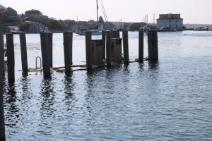 Rising seas threaten the infrastructure needed for jobs, industry, recreation and everyday life. Roads, bridges, subways,
port facilities, piers, docks, oil and gas wells, power (including nuclear!) plants, sewage treatment plants, coastal
levies -- the list is practically endless -- are all at risk from sea level rise. Rising seas threaten fish habitat, including
coral reefs and mangrove forests, and freshwater aquifers. Rising seas are leading to rapid coastal erosion of cliffs
and dunes in some local shoreline regions and affect shoreline access for recreational activities. The seas are rising
and will rise faster later this century. The historical data is clear and the scientific consensus is unequivocal. Even
so, the rate of change is small, and the desire to adapt to sea level increase is not overwhelming. This is unfortunate
because sea level rise directly affects public safety, local fisheries, shipping and trade. Indeed, since human society
has flourished during a period of relative sea level stability, almost all of our coastal infrastructure and livelihood
is built around the current height of the ocean.
Rising seas threaten the infrastructure needed for jobs, industry, recreation and everyday life. Roads, bridges, subways,
port facilities, piers, docks, oil and gas wells, power (including nuclear!) plants, sewage treatment plants, coastal
levies -- the list is practically endless -- are all at risk from sea level rise. Rising seas threaten fish habitat, including
coral reefs and mangrove forests, and freshwater aquifers. Rising seas are leading to rapid coastal erosion of cliffs
and dunes in some local shoreline regions and affect shoreline access for recreational activities. The seas are rising
and will rise faster later this century. The historical data is clear and the scientific consensus is unequivocal. Even
so, the rate of change is small, and the desire to adapt to sea level increase is not overwhelming. This is unfortunate
because sea level rise directly affects public safety, local fisheries, shipping and trade. Indeed, since human society
has flourished during a period of relative sea level stability, almost all of our coastal infrastructure and livelihood
is built around the current height of the ocean.
The HeroX Challenge
A wealth of ocean data has been and is being collected. Many of the datasets are open, yet very few are being used for resource management, business, or conservation. Most businesses, let alone individuals, do not have the time or ability to translate ocean data into actionable information, yet large industries and millions of people rely on the ocean for their livelihoods and well-being.
So long as ocean data remain disconnected from services that people and markets can use, we will be unable to engage the numbers of actors needed to address critical ocean challenges. Data collection is not evenly distributed across the ocean -- some regions are in need of data acquisition, a need that could be addressed through the development of demand for data services, which will in turn drive demand for data collection tools. Overall, there is a market failure for meaningful data services, and the time is ripe for market development.
You can read more about our HeroX submission on our application page.
The Data and Map Technology
NOAA Coastal Planning Sea Level Modeling
Data for the sea level rise overlay shown in our app are from the NOAA Office for Coastal Management. Modeling of relative sea level rise is complicated, and requires more than just moving sea level up by some number. NOAA provides these data for free via a WMS server for easy integration.
Powered by Mapbox
Mapping on web pages and smartphones has become a central use case many are familiar with when they use a directions service to find a new location. We leverage this technology by integrating NOAA's geospatial data with the great technology provided by Mapbox. They make it very easy to get started and make maps that look great, perform fast and combine lots of different types of information.
Backend As A Service by Kinvey
We knew we needed to have a backend to manage users and any data uploaded to our system for processing once we get the Augmented Reality tech to work. Initially we thought to roll our own setup until we realized that Kinvey offers an amazing product they call "Backend as a Service". Translation? We don't have to manage the backend service and re-invent a wheel that already works great!
The Team
- Christian Sarason, Immersed In Science (Lead)
- Matt Pruis, Sage Data Science (Science Lead)
- Landung (Don) Setiawan, Staff at Applied Physics Lab (Software Engineer)
- Malea Saul, Student at University of Washington School of Oceanography